Little Mill Creek coordinates
-
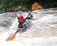
perspective7
- ....

- Posts: 487
- Joined: Tue Feb 10, 2009 6:20 pm
- Name: Seth
- Location: Springfield, MO 417-761-9091
- Contact:
Little Mill Creek coordinates
I've been looking at Little Mill creek and was wondering if anyone has the coordinates for the put-in & takeout...think I found the takeout on Google earth, but... Thanx in advance!

Re: Little Mill Creek coordinates
Watch out for the Mill Creek Freaks that reside in that area. Been known to want to jump in and go paddling with you.
Don't have the coordinates but the take out is where Wilson Lane crosses Little Mill about 1/2 mile east of Hwy 215.
The put in is optional depending on water level and thrill level desired. Look for the confluence of the three forks of Little Mill and follow the eastern most fork up about a mile or a little less. That should put you near Fern Gulley.
I'm sure Nick or Rob will post some more current info on the FS road availability and put in options.
Great Run!
Dave Robertson
"Endeavor to persevere." And when we had thought about it long enough, we declared war on the Union.....
Chief Dan George in The Outlaw Josey Wales 1976 https://www.youtube.com/watch?v=hRX6hSGeZs4
"Endeavor to persevere." And when we had thought about it long enough, we declared war on the Union.....
Chief Dan George in The Outlaw Josey Wales 1976 https://www.youtube.com/watch?v=hRX6hSGeZs4

Re: Little Mill Creek coordinates
This shows the turnoff from 215 to the road that splits to Fern Gully and Little Mill: http://maps.google.com/maps?f=d&source= ... 8&t=h&z=15" onclick="window.open(this.href);return false;
To get to Little Mill you take the left side, then you'll have to hoof it.
I'll try to get some coordinates or better directions later today.
To get to Little Mill you take the left side, then you'll have to hoof it.
I'll try to get some coordinates or better directions later today.
Re: Little Mill Creek coordinates
http://www.ozarkpages.com/cgi-bin/crfind.pl?LMill" onclick="window.open(this.href);return false;
To the putin: Follow the directions above or use the map from my earlier post to get to the Y that splits to the Fern Gulley putin on the right, and Little Mill on the left. When you head left at the Y, at the start you will have to cross a large hump that won't be crossable in a low clearance vehicle. Drive down this road till it ends at a small field and park there. Drag your boat in the same direction the road was going before it ended, there is a bit of a trail there. After 80 yards or so, you will come to a T in the trail, turn right. After about 1/4 mile or so, the trail will turn sharp left and start getting steeper down hill. Stay on the trail if you want to go to the putin just above the 3 forks. If you want to putin at Rocket Slide http://iYak.smugmug.com/gallery/8117962 ... FVCJo-A-LB" onclick="window.open(this.href);return false; , you need to exit the trail on the right. At the spot where you exit the trail there is a small bluff on the right(4 feet) and small clearing (enough room for your group to huddle together and look off the small bluff while you're wondering if that is the correct spot or not, but no bigger than that). If you are standing on the bluff, look straight down into the valley and you should see some orange tape hanging from a tree - this marks the trail. Follow the markers downhill and to the right till you get to the big bluff. If the bluff is to big, head right to find a better place to walk down.
To the putin: Follow the directions above or use the map from my earlier post to get to the Y that splits to the Fern Gulley putin on the right, and Little Mill on the left. When you head left at the Y, at the start you will have to cross a large hump that won't be crossable in a low clearance vehicle. Drive down this road till it ends at a small field and park there. Drag your boat in the same direction the road was going before it ended, there is a bit of a trail there. After 80 yards or so, you will come to a T in the trail, turn right. After about 1/4 mile or so, the trail will turn sharp left and start getting steeper down hill. Stay on the trail if you want to go to the putin just above the 3 forks. If you want to putin at Rocket Slide http://iYak.smugmug.com/gallery/8117962 ... FVCJo-A-LB" onclick="window.open(this.href);return false; , you need to exit the trail on the right. At the spot where you exit the trail there is a small bluff on the right(4 feet) and small clearing (enough room for your group to huddle together and look off the small bluff while you're wondering if that is the correct spot or not, but no bigger than that). If you are standing on the bluff, look straight down into the valley and you should see some orange tape hanging from a tree - this marks the trail. Follow the markers downhill and to the right till you get to the big bluff. If the bluff is to big, head right to find a better place to walk down.
Social Media
Who is online
Users browsing this forum: Semrush [Bot] and 6 guests