
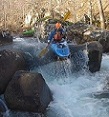
Gannon and I took out first descents of the East branch of Gulpha creek(that's what google earth called it). And FYI, if you put in at the Bald Mountain ridge road there is a large river wide strainer, shortly down river.
Also, Pretty sure we found the guage where we launched at(Bald Mountain road bridge).
I was wondering if this is the guage showing up in USGS for Gulpha creek. Because it located under a bridge that forms a large pool and wouldn't have much flow. Just hoping someone knows we're right in thinking its the guage. This would explain why there is a huge difference in 4.3 and 4.2.
It also appears that the two forks are from different watersheds. So if the east branch is running(if the guage is on the Bald Mountain road bridge), the better run which is Gulpha creek(main branch) may not be running.
Just wanting some local knowledge on where the guage is located, so as to have a better idea of how to correlate the run to the CFS' and height.
Thanks!
Location of Gulpha creek guage, maybe?
Location of Gulpha creek guage, maybe?
Henry Ford said "If I had asked people what they wanted, they would have asked for faster horses."

Re: Location of Gulpha creek guage, maybe?
USGS website shows gage "07358550 gulpha creek at hot springs" is located at 34.5089, -93.0092 which appears to be on the Hwy 70 (E Grand Ave) bridge.
Bryan Signorelli
Re: Location of Gulpha creek guage, maybe?
Oh and the gage appears to be on the Middle Branch Gulpha Creek.
Bryan Signorelli
-
gma06001-
- ..

- Posts: 127
- Joined: Tue Feb 08, 2011 6:56 pm
- Name: Mitch Allen
- Location: Central, Arkansas
Re: Location of Gulpha creek guage, maybe?
A few others including myself have run the East Fork Gulpha as well, never noticed that gauge though. Like you said, it could definitely benefit from some willow/alder trimming in the first part. When I worked for the park service in Hot Springs it was to my understanding that the guage was on park service property near Gulpha Gorge (under Grand Ave most likely). From my observation, this past time the gauge was slightly innaccurate due to a large amount of flow coming out of the Middle Fork Gulpha which comes into Gulpha below the gauge. I got off on Mill Creek Rd. (where Middle Fork Gulpha crosses under Grand Ave.) this past time going to a friends house to borrow a saw to cut some trees on Gulpha Creek. I noticed the Middle Fork was much muddier and higher on the concrete pilings of the bridge than it usually is when we run Gulpha Creek at 4.2- 4.3.
Atleast that is what I put together from all of it. I was pretty intrigued by the storm and how it was so isolated over small watersheds. I went out to check our project site on the Middle Fork Saline River yesterday and, although the North Fork Saline was muddy and in the trees, the Middle Fork was at normal low flows.
-Mitch Allen
-
Cowper

- .....

- Posts: 2423
- Joined: Sun Jul 10, 2005 10:39 am
- Name: Cowper C
- Location: Conway, AR
- Contact:
Re: Location of Gulpha creek guage, maybe?
Doug and I already discussed this, but I'll share here for the benefit of others.
The gage you see at Bald Mountain road can be accessed via "drilling down" from the Entergy hydro web page. Or go here:
http://contrail.onerain.com/login.php?c ... automatic=" onclick="window.open(this.href);return false;
Login as "Entergy" with the password "guest".
On the menu bar, look for "sites", that will pop up a list that includes the link to the East Gulpha gage at Bald Mountain road.
In case you're wondering, this is info is provided by Entergy as a public service on their web site, I'm not sharing any "company secrets" here.
Trash: Get a little every time you go!
-
CAPTAIN ALEVE
- .....
- Posts: 730
- Joined: Fri Jul 01, 2005 2:19 pm
- Name: Mike Coogan
- Location: Little Rock
- Contact:
Re: Location of Gulpha creek guage, maybe?
I have always used Hots Springs Creek as a level indicator for Gulpha Creek, but the gage has been replaced and I don't have a correlation for the new gage:
http://waterdata.usgs.gov/ar/nwis/uv?site_no=07358284" onclick="window.open(this.href);return false;
Someone needs to post a photo of the downstream side of the pedestrian bridge in Greenway Park (the put-in) and tell us what the gage reading was when the photo was taken.
Captain Aleve, alias Mike Coogan
PHOTOS: http://www.flickr.com/photos/17863908@N03/sets/" onclick="window.open(this.href);return false;
More paddling info at http://class2arkansas.com/" onclick="window.open(this.href);return false;
More paddling info at http://class2arkansas.com/" onclick="window.open(this.href);return false;
Social Media
Who is online
Users browsing this forum: No registered users and 1 guest