Does anybody know where the South Fourche is ? And has anyone yak the creek latey and whats the lowest you can run it?
thanks nathan
South Fourche
-
nproctor
- ....

- Posts: 356
- Joined: Sat Jun 18, 2011 5:06 am
- Name: nproctor
- Location: Scottsville
- Contact:
South Fourche
https://www.facebook.com/nathan.r.proctor" onclick="window.open(this.href);return false;
https://vimeo.com/user10830701" onclick="window.open(this.href);return false;
https://facebook.com/Fallingwatertv" onclick="window.open(this.href);return false;
https://vimeo.com/user10830701" onclick="window.open(this.href);return false;
https://facebook.com/Fallingwatertv" onclick="window.open(this.href);return false;
-
Chicago Bob

- ....
- Posts: 420
- Joined: Mon Apr 11, 2011 11:18 am
- Name: Bob Tyler
- Location: Hot Springs Village
Re: South Fourche
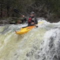
Nathan the South Fourche LaFave River is located just south of Hollis Arkansas on Highway 7. It's about halfway between Russellville and Hot Springs. The river is runnable down to 3.5 feet but is best between 4.5 and 6 feet. It can be run at higher levels but requires greater than Class II skills. I ran it Sunday, Tuesday and Wednesday of this week and another group from the club ran it on Monday. The 11 mile run from Highway 7 to the Deberrie Low Water Bridge is described in Tom Kennon's A Canoeing & Kayaking Guide to the Ozarks (3rd Edition) Hope this helps. BOB
-
nproctor
- ....
- Posts: 356
- Joined: Sat Jun 18, 2011 5:06 am
- Name: nproctor
- Location: Scottsville
- Contact:
Re: South Fourche
Thanks Bob!!!!! 
https://www.facebook.com/nathan.r.proctor" onclick="window.open(this.href);return false;
https://vimeo.com/user10830701" onclick="window.open(this.href);return false;
https://facebook.com/Fallingwatertv" onclick="window.open(this.href);return false;
https://vimeo.com/user10830701" onclick="window.open(this.href);return false;
https://facebook.com/Fallingwatertv" onclick="window.open(this.href);return false;
Social Media
Who is online
Users browsing this forum: No registered users and 0 guests