

As the unofficial Ms chapter of the ACC (of 1) I wanted to share a trip report that I put on Everytrail.com
http://www.everytrail.com/view_trip.php ... ce00dda3ba" onclick="window.open(this.href);return false;
I've been messing with this program for a few months and its ok except for the speeds and elevations graph. I don't think I've gotten my Prijon to 80 mph (not even on the interstate) and I haven't had those drastic elevation changes. 3-4 feet scares me...lol
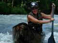
Mississippi Trip Report
Mississippi Trip Report
Not that Al
-
Shark Attack

- ....

- Posts: 443
- Joined: Fri Aug 19, 2005 5:09 pm
- Location: Round Mountain, AR
-
msullivan57
- .

- Posts: 65
- Joined: Thu Mar 22, 2007 11:55 am
Re: Mississippi Trip Report
That trip looked pretty rough. Good practice for what I hope are some upcoming bayou trips in Arkansas this fall.
Have a question. What program did you use to attach your photo slideshow to your Google Earth map? Nice touch.
Thanks for the report.
Mike
Have a question. What program did you use to attach your photo slideshow to your Google Earth map? Nice touch.
Thanks for the report.
Mike

Re: Mississippi Trip Report
Wow! That is really a neat program! I would love to have that for the upcoming Fall Wetlands Tour.
Also, I am impressed by your getting out there in the heat. I usually like to paddle in the the swamp in the summer but it has been too hot recently for even me
I have been thinking about our fall trips and will be getting the schedule out after Rendezvous.
There will be a Geocaching contest and paddling trip on Lake Cathrine at Rendezvous. There will be several caches and a prize for the person who locates the final cache first. I will be putting up a separate post about that very soon.
“What we do for ourselves dies with us. What we do for others and the world remains and is immortal.” Albert Pine
Re: Mississippi Trip Report
Mike,
You have the option to upload trips straight from your GPS, upload a GPX file to it, or draw your route on the map. You can also upload pics to the spot where you took them.
In my case I have the app on my iPhone (its also available for the Droid also). It tracks as I go and as I take pics with the phone, it will preview the pic and ask if I want to use it. You can also edit your pics after you upload them. Its free to join and there is a free app and a paid one. You can read their forums to determine which you want. (I can mess the free one up enough)
It was rather nasty in spots there. I was amazed at the way the rotting vegetation on the bottom would release gases as I poled through some spots. Apparently there are lots of wild hogs around too, judging by the way the banks and paths looked. When I got home I was ushered straight to the tub by my wife and a scotchbrite scrub had to be called in to remove something the washrag wouldn't touch.
I needed the practice getting out of my kayak (as some here can attest). I had to cross 2 beaver dams each way and drag through a few spots. At least it wasn't 18°F
Not that Al
-
msullivan57
- .
- Posts: 65
- Joined: Thu Mar 22, 2007 11:55 am
Re: Mississippi Trip Report
C8mb, think your name is Al, I reviewed the Every Trail site and noted they also have software for my Blackberry. Don't think my blackberry takes photos the quality of your iphone. That got me thinking they must make cameras with gps built into them. And they do. Samsung and Sony for sure have some models with gps receivers. Also, there are geotagging devices as accessories to digital cameras without gps. So there seems to be some very useful equipment allowing you to identify exactly where you took a photo. Thanks for introducing this software. Now I've got to go spend more money on camera equipment.
On another subject, those prijon kayaks. My prijon is also hard to get in and out of, especially during those portages. Don't think that it is because I am clumsy. That can't be it. It is some flaw in their design. So, I am thinking about installing a door on mine so I can just open it and step out. If I figure out how to do this I'll let you know.
On another subject, those prijon kayaks. My prijon is also hard to get in and out of, especially during those portages. Don't think that it is because I am clumsy. That can't be it. It is some flaw in their design. So, I am thinking about installing a door on mine so I can just open it and step out. If I figure out how to do this I'll let you know.
-
Butch Crain
- ...

- Posts: 309
- Joined: Tue Jun 12, 2007 1:10 pm
- Location: Arcadia, Louisiana
Re: Mississippi Trip Report
Neat program and a great way to trip report.
Frequently on this board there are posts with anecdotes regarding various environmental issues.
There's no better documentation than a geotagged, time stamped video or photo.
Frequently on this board there are posts with anecdotes regarding various environmental issues.
There's no better documentation than a geotagged, time stamped video or photo.
Social Media
Who is online
Users browsing this forum: No registered users and 1 guest