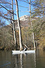

The Lower White River State Park at Des Arc has a 1900 map of streams, trails and tramways in the area where the White, Cache and Bayou deView converge.
Some things have changed but they suggest possible paddling trips, canoe trails from one river to the other.
Old Map of Bayou deView, Cache and White
Old Map of Bayou deView, Cache and White
- Attachments
-
Re: Old Map of Bayou deView, Cache and White
One more part of the map. Benson slash used to wander to Hickson Lake.
- Attachments
-


Re: Old Map of Bayou deView, Cache and White
Thanks for sharing. Really enjoyed looking at these old maps. I did not know about the park at Des Arc. Will plan to make a trip over there to check it out. I am always interested in anything related to the White and Cache rivers.
Be who you are and say what you feel, because those who mind don't matter and those who matter don't mind. Dr Theodor Seuss
It is harder to conceal ignorance than to acquire knowledge. Arnold Glasgow
It is harder to conceal ignorance than to acquire knowledge. Arnold Glasgow
Re: Old Map of Bayou deView, Cache and White
I like maps and am glad you appreciated this one. The park is very small, basically one large room. It is a resource for school kids in the area and they do not seem to have the volunteer support of a Pinnacle.
I wonder if the ACC might be able to help with something, a paddling excursion as part of a weekend experience for kids, for example.
Some reforestation programs along some of the Cache tributaries and backwaters in this area just got federal money. Nature Conservancy and other water groups got the grants.
Social Media
Who is online
Users browsing this forum: No registered users and 28 guests