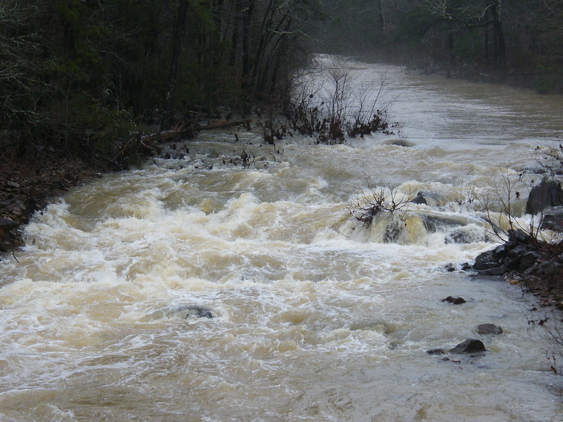
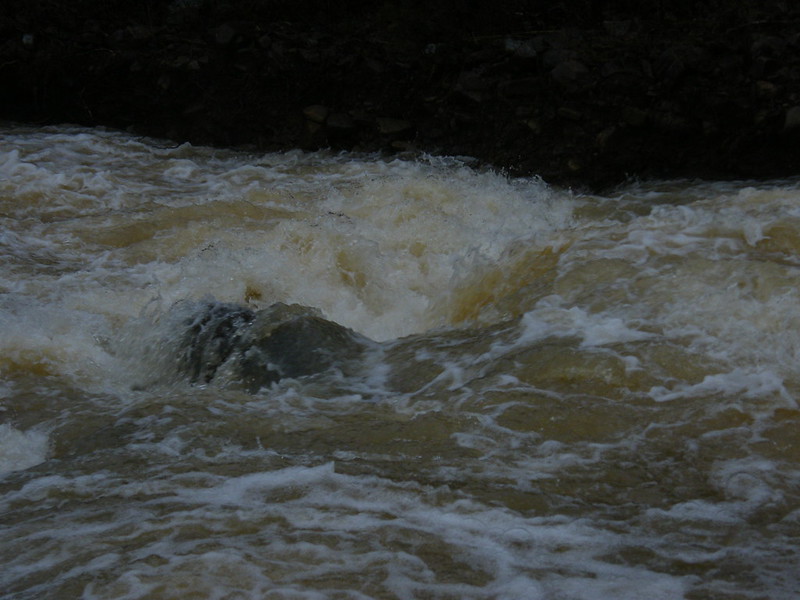
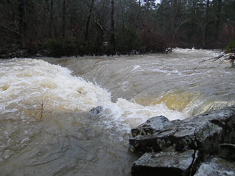
The water should be down to a safe level by Sunday for a
*********** POSSIBLE FIRST DESCENT ***********
of this Class II-II++ creek southwest of Danville. The take-out is at Highway 28 at Bluffton; put-in is up in the Ouachita Mountains. The approximately 6 mile run will be fast paced through a remote mountain valley down in to pasture land.
I can meet people in Little Rock at the Wal-Mart at Chenal and Hwy. 10 at 9:00 a.m. and then at the Plainview grocery store/gas station at the intersection of Hwys. 60 and 28 at about 10:45.
The trip won't happen unless I get some paddlers to join in. Post here if you are going to join in, or call me at 501-681-2314. I will post updates here.
Photos of some of the creek are available on Flickr: https://www.flickr.com/photos/17863908@ ... 5019986630
Mike Coogan
SUNDAY MAY 1ST EAST GAFFORDS CREEK
-
CAPTAIN ALEVE
- .....

- Posts: 729
- Joined: Fri Jul 01, 2005 2:19 pm
- Name: Mike Coogan
- Location: Little Rock
- Contact:
SUNDAY MAY 1ST EAST GAFFORDS CREEK
PHOTOS: http://www.flickr.com/photos/17863908@N03/sets/" onclick="window.open(this.href);return false;
More paddling info at http://class2arkansas.com/" onclick="window.open(this.href);return false;
More paddling info at http://class2arkansas.com/" onclick="window.open(this.href);return false;
-
CAPTAIN ALEVE
- .....

- Posts: 729
- Joined: Fri Jul 01, 2005 2:19 pm
- Name: Mike Coogan
- Location: Little Rock
- Contact:
Re: SUNDAY MAY 1ST EAST GAFFORDS CREEK
Two paddlers so far, so the trip is on.
Mike
Mike
PHOTOS: http://www.flickr.com/photos/17863908@N03/sets/" onclick="window.open(this.href);return false;
More paddling info at http://class2arkansas.com/" onclick="window.open(this.href);return false;
More paddling info at http://class2arkansas.com/" onclick="window.open(this.href);return false;
-
CAPTAIN ALEVE
- .....

- Posts: 729
- Joined: Fri Jul 01, 2005 2:19 pm
- Name: Mike Coogan
- Location: Little Rock
- Contact:
Re: SUNDAY MAY 1ST EAST GAFFORDS CREEK
You can probably catch us at the put-in about noon if anyone else decides to come. Take Bluff Road south from Hwy. 28 a couple miles until you pass the creek on your right as you descend a steep hill. Go a little farther along the creek until the road becomes paved, go left on the dirt road to Chula right where the pavement starts, go up the mountain and back down on the road to Chula, cross a high bridge over Cedar Creek and go 0.2 miles to where the road and the creek come side by side, drag down to the water. We may park on a side road that heads toward the creek a little way short of the put-in, but you can probably park on the side of Bluff Road.
Mike
Mike
PHOTOS: http://www.flickr.com/photos/17863908@N03/sets/" onclick="window.open(this.href);return false;
More paddling info at http://class2arkansas.com/" onclick="window.open(this.href);return false;
More paddling info at http://class2arkansas.com/" onclick="window.open(this.href);return false;
Re: SUNDAY MAY 1ST EAST GAFFORDS CREEK
Hello,
Are putting in at Bluff rd/ caney creek? Or further up at bluff and 141 ?
Looks like a decent classII+
THANKS
Erik
Are putting in at Bluff rd/ caney creek? Or further up at bluff and 141 ?
Looks like a decent classII+
THANKS
Erik
You don't quit playing because you get old, you get old because you quit playing!
Re: SUNDAY MAY 1ST EAST GAFFORDS CREEK
Those pics have me lickin' my chops  , but, alas, Aleve, me thinks the rec boat is not up to the task of the tight turns.
Paddle on, Cap'n, paddle on! You da man!
Paddle on, Cap'n, paddle on! You da man!
-
CAPTAIN ALEVE
- .....

- Posts: 729
- Joined: Fri Jul 01, 2005 2:19 pm
- Name: Mike Coogan
- Location: Little Rock
- Contact:
Re: SUNDAY MAY 1ST EAST GAFFORDS CREEK
TRIP REPORT: This was a fun creek trip; no swims, no flips or rolls, but lots of maneuvering. Erik Smith and Calvin Doody joined me for the six miles that took about five hours. The lengthy time was due to some very slow going on the upper section which is full of tight turns and very little calm water. It was a workout, but not beyond the abilities of a Class II+ paddler. In spite of the 4 inches of rain that fell on Friday, we could have used more water for Sunday's trip. In the future I would judge the water level by looking at Campground Rapid, just upstream of the Forest Service bridge on 970. Here is video of us at that rapid, the biggest rapid on the creek:
https://vimeo.com/165318554
If the water at Campground Rapid is at least as high as it is in the video you'll be able to paddle the creek with a few scrapes. Best paddling would probably be when the water is another 6" - 12" higher, but NOT as high as it is in the pictures of Campground Rapid below.
 Campground Rapid at high flow 1 by CaptainAleve, alias Mike Coogan, on Flickr
 Campground Rapid at high flow 2 by CaptainAleve, alias Mike Coogan, on Flickr
 Campground Rapid at high flow 3 by CaptainAleve, alias Mike Coogan, on Flickr
Here's a high water photo of the ledge just above Campground Rapid. You can actually drive to this ledge.
 Ledge above Campground Rapid by CaptainAleve, alias Mike Coogan, on Flickr
Students of river morphology will be excited when they get close to the take-out on Highway 28. The creek has begun to actively cut across the last bend. A year ago I saw evidence that extremely high flows were flowing over wooded land that separated two sections of the creek. The top of the bank was bare except for trees and the ground was lower than the rest of the bank. The downstream end of the short cut looked vaguely like water had been flowing through the woods. On this trip we were able to paddle/slide into the cut and drop in the main channel down below. The downstream side of the cut looked like a bomb had gone off and blown away the clay/gravel matrix bank. Medium to high flows will now be sending high energy water into the channel just upstream of the bridge. It's hard to say what further changes will have occurred here by next year. Here's an aerial photo from Google that shows how slender the width across the loop had become. There is a pool on the downstream side of the spot where the bend is being cut off.
 Gaffords cut off by CaptainAleve, alias Mike Coogan, on Flickr
I'm looking forward to paddling the next creek in the Ouachitas with you guys, whichever creek that turns out to be.
Mike
https://vimeo.com/165318554
If the water at Campground Rapid is at least as high as it is in the video you'll be able to paddle the creek with a few scrapes. Best paddling would probably be when the water is another 6" - 12" higher, but NOT as high as it is in the pictures of Campground Rapid below.
 Campground Rapid at high flow 1 by CaptainAleve, alias Mike Coogan, on Flickr
 Campground Rapid at high flow 2 by CaptainAleve, alias Mike Coogan, on Flickr
 Campground Rapid at high flow 3 by CaptainAleve, alias Mike Coogan, on Flickr
Here's a high water photo of the ledge just above Campground Rapid. You can actually drive to this ledge.
 Ledge above Campground Rapid by CaptainAleve, alias Mike Coogan, on Flickr
Students of river morphology will be excited when they get close to the take-out on Highway 28. The creek has begun to actively cut across the last bend. A year ago I saw evidence that extremely high flows were flowing over wooded land that separated two sections of the creek. The top of the bank was bare except for trees and the ground was lower than the rest of the bank. The downstream end of the short cut looked vaguely like water had been flowing through the woods. On this trip we were able to paddle/slide into the cut and drop in the main channel down below. The downstream side of the cut looked like a bomb had gone off and blown away the clay/gravel matrix bank. Medium to high flows will now be sending high energy water into the channel just upstream of the bridge. It's hard to say what further changes will have occurred here by next year. Here's an aerial photo from Google that shows how slender the width across the loop had become. There is a pool on the downstream side of the spot where the bend is being cut off.
 Gaffords cut off by CaptainAleve, alias Mike Coogan, on Flickr
I'm looking forward to paddling the next creek in the Ouachitas with you guys, whichever creek that turns out to be.
Mike
PHOTOS: http://www.flickr.com/photos/17863908@N03/sets/" onclick="window.open(this.href);return false;
More paddling info at http://class2arkansas.com/" onclick="window.open(this.href);return false;
More paddling info at http://class2arkansas.com/" onclick="window.open(this.href);return false;
Social Media
Who is online
Users browsing this forum: No registered users and 0 guests

