illinois bayou
-
Jmwilliams
- .

- Posts: 1
- Joined: Mon May 25, 2015 10:04 am
illinois bayou
Does anyone have a map of launch and take outs. Jmwilliams4618@gmail.com
Re: illinois bayou
Flatwater sections are first bridge north of Hector on Highway 27 (put-in) and take-out at bridge on county road (no idea of number) at Scottsville.
Whitewater runs with access points:
Nogo run: Put in at low water bridge which is reached by driving north to Nogo on Hwy 27 and turning left at church/cemetery and going down the mountain till you reach it. Take out is usually at Snow Creek or second bridge on Hwy 27 north of Hector.
Snow Creek run: Gets its name from the small creek that flows into the IB at put-in which is reached by taking county road along side of stream on west side (turn before you cross the bridge). Take out is usually at bridge. Good for laps and walking your own shuttle.
Bridge to bridge run: Put in at second bridge on Hwy 27 and take out at first bridge.
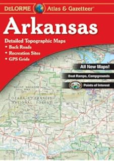
The Arkansas Gazetteer is good source for finding this kind of info if you don't have one:

http://www.amazon.com/Arkansas-Atlas-Ga ... 089933203X" onclick="window.open(this.href);return false;
http://www.ozarkpages.com/cgi-bin/crfind.pl?IllinoisB" onclick="window.open(this.href);return false;
Whitewater runs with access points:
Nogo run: Put in at low water bridge which is reached by driving north to Nogo on Hwy 27 and turning left at church/cemetery and going down the mountain till you reach it. Take out is usually at Snow Creek or second bridge on Hwy 27 north of Hector.
Snow Creek run: Gets its name from the small creek that flows into the IB at put-in which is reached by taking county road along side of stream on west side (turn before you cross the bridge). Take out is usually at bridge. Good for laps and walking your own shuttle.
Bridge to bridge run: Put in at second bridge on Hwy 27 and take out at first bridge.
The Arkansas Gazetteer is good source for finding this kind of info if you don't have one:

http://www.amazon.com/Arkansas-Atlas-Ga ... 089933203X" onclick="window.open(this.href);return false;
http://www.ozarkpages.com/cgi-bin/crfind.pl?IllinoisB" onclick="window.open(this.href);return false;
I am I plus my surroundings and if I do not preserve the latter, I do not preserve myself. Jose Ortega Y Gasset
The earth is like a spaceship that didn't come with an operating manual.
Buckminster Fuller
The earth is like a spaceship that didn't come with an operating manual.
Buckminster Fuller
Social Media
Who is online
Users browsing this forum: Google [Bot] and 0 guests
