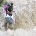
I am looking more info on this stretch of river. I understand it is 9 miles long, class I-II, and the DeQueen gauge needs to read 4-8 feet. I was looking for better directions to the put-in and take-out as well as info on dam releases. Is it better to go during or after a dam release? Should we stay off the river if one is scheduled? I am looking to take some friends/family and they all have recreational kayaks. We would probably stay at the Cossatot Reefs campground if you have any reviews of the place.
Thanks!
Cossatot - Gillham Dam to Weyerhauser 80000
-
Cabra Loca 87
- .

- Posts: 57
- Joined: Mon Apr 09, 2012 9:25 am
- Name: Reese
- Location: Mount Vernon, TX
-
Cowper

- .....

- Posts: 2423
- Joined: Sun Jul 10, 2005 10:39 am
- Name: Cowper C
- Location: Conway, AR
- Contact:
Re: Cossatot - Gillham Dam to Weyerhauser 80000
It's been too many years since I was there for me to be giving directions, and google earth isn't cooperating right now so I can't even fabricate some for you, so I'll just have to help with part of your question.
With no generation, I think you would be dragging at every shoal, to the point that it might not be fun any more. Some were longer shoals, so it could be a fair amount of dragging, most likely over very slippery rocks. So try to figure when they will be generating, and go with that.
You might be able to get some better intel from the folks at the state park; they have a few recreational kayaks so they might know something about the lower part of the river too. Also, I'm pretty sure they do short floats from Deer camp and from the old Hwy 4 bridge downstream above the lake, so they could tell you about those options for sure, or maybe even "lead" you on a float (AKA, go with you and help with the shuttles and unlocking the gate for access...)
Trash: Get a little every time you go!
-
Cowper
- .....
- Posts: 2423
- Joined: Sun Jul 10, 2005 10:39 am
- Name: Cowper C
- Location: Conway, AR
- Contact:
Re: Cossatot - Gillham Dam to Weyerhauser 80000
OK, Google Earth was behaving this morning, so here’s an update on the directions. From your description, I suspect you have already read the stuff on Southwest Paddler, at http://southwestpaddler.com/docs/little5.html" onclick="window.open(this.href);return false;
This would be “easy” now, except for one thing: Marc (SW paddler) apparently has some typo’s in his GPS coordinates. (It happens, I’ll send him an e-mail).
The correct location for the put in is: N34.2081 W94.2289
(I’m assuming the put in is near the dam; if signs direct you to the campground instead, then go with that.)
And the correct location of W road 80000 (also known as County Road 70) is: N34.11069 W94.20626
If you have a GPS or car navigation system of any kind, you should be able to enter those numbers into the system. If you don’t, then go to this web link:
https://maps.google.com/" onclick="window.open(this.href);return false;
“Cut and past” those coordinates into the search bar. You can then hit the “Directions” tab, and enter any starting point you choose (GPS coordinates, street address, or even just a local town like “Wickes, AR”), and get a detailed turn-by-turn set of directions.
I also recall a really nice surfing wave (when they are releasing) at the take out bridge; but don't remember whether we were taking out at the first bridge, or at W80000. It was good enough that we even drove down to "park and play" a couple of times, so that is something you could do on the day you have to start your drive home. It was fun in a tandem canoe, so I think your touring kayaks would also find it "surfable" if it is still there and not gone due to gravel bar changes or something.
For release information, I can only suggest you try calling the Corps. Contact information for Gillham was listed as:
DeQueen Project Office
706 DeQueen Lake Road
DeQueen, Arkansas, 71832
(870) 584-4161
Trash: Get a little every time you go!
-
Cabra Loca 87
- .
- Posts: 57
- Joined: Mon Apr 09, 2012 9:25 am
- Name: Reese
- Location: Mount Vernon, TX
Re: Cossatot - Gillham Dam to Weyerhauser 80000
Thanks for the information Cowper. You have given me a lot to start with!

Re: Cossatot - Gillham Dam to Weyerhauser 80000
The Gillham project is not hydro so it is flood control only. It does tend to run more often than Dierks since the watershed is alot larger. It is a pretty long float and the take out is a bit hard to find so would suggest gps. You can shorten the float by taking out at King Rd (or King something) but check it out first as I think it is a pretty steep access. Good easy float but long if you don't have close to at least 5 ft. of water. LMF has alot more action if you're not tired of going there.
Just living the liquid lifestyle!!!
Jim Enns <*)))))))))><
Jim Enns <*)))))))))><
-
Cabra Loca 87
- .
- Posts: 57
- Joined: Mon Apr 09, 2012 9:25 am
- Name: Reese
- Location: Mount Vernon, TX
Re: Cossatot - Gillham Dam to Weyerhauser 80000
Thanks Jim, just looking at other options within a 3 hour radius. I found directions on Americanwhitewater, but it says shuttle takes about an hour one way.
Social Media
Who is online
Users browsing this forum: No registered users and 1 guest