War eagle info?
-
fishhomer75
- .

- Posts: 64
- Joined: Mon May 11, 2009 2:57 pm
- Name: Peter E.
- Location: Little Rock
War eagle info?
Time is coming near for mine and a friends annual smallmouth weekend. We try to hit new water as often as we can. Osage and war eagle creeks are tops on our hit list of streams we have not floated. Looking for any info on access and trip distances on war eagle. Found some guys blog that has a number for war eagle canoeing and camping. Anyone ever used them? I figure we will use Ernie at kings river outfitters for the Osage. Thx in advance for any info. Peter
-
cpresoz
- .....

- Posts: 605
- Joined: Mon Feb 07, 2011 10:13 am
- Name: Curtis Presley
- Location: Fayetteville, Arkansas
Re: War eagle info?
We've floated from the old bridge next to Hwy. 412 to Withrow Springs which is 4.5 miles and it's got bluffs that almost compare to the Buffalo. This Sunday we're floating from Withrow Springs to Hwy. 45 which is 12.7 miles. It's going to be low, but I'm told you can float at 2.0 feet at the gauge at Hwy. 45 near Hindsville.
-
fishhomer75
- .
- Posts: 64
- Joined: Mon May 11, 2009 2:57 pm
- Name: Peter E.
- Location: Little Rock
Re: War eagle info?
Thx for the reply. Do you guys self shuttle or use an outfitter? Look forward to trip report. The 4.5 mile section might be perfect to fish pretty hard Sunday and still get back to the Rock at a reasonable time.
Re: War eagle info?
Hwy. 412 to Hwy 23 is a good fishing float. We floated and fished it on Monday morning. I don't know of anybody who runs a shuttle on that end of the creek though, but it's only about 5 miles on the highway from bridge to bridge.
We also floated Rocky Ford to Parker's Ford the other day. It's a section between Hwy. 23 and Hwy. 45. Water was right over 2' on the Hindsville gauge. We drug a little but not too bad. There's a tree across the creek about a quarter down stream from Rocky Ford but it's pretty easy to get around, just a short portage to the right. Other than that it was pretty smooth sailing.
Good luck.
-
cpresoz
- .....
- Posts: 605
- Joined: Mon Feb 07, 2011 10:13 am
- Name: Curtis Presley
- Location: Fayetteville, Arkansas
Re: War eagle info?
We've always self shuttled. You can rent canoes from the State Park at Withrow Springs and they shuttle those. It's possible they might shuttle your boat or car. The ranger has a couple of young guys working for him, so they either will through the park or maybe on the side. There's a gas station/bait shop there on 412 not far from the put in. I bet they'd either run your ride down for you or know someone who would. There's always wade fishermen and guys in their little float set ups fishing and they're always catching stuff. There's a couple of fields that the good old boys access the river along that stretch from. The ranger would know these spots. It's a hidden treasure and it's a beauty.
WhiteOak, thanks for the head's up. Sounds like 2 feet isn't too awful bad. I can't talk my friends into the Mulberry or Piney. . .yet!
WhiteOak, thanks for the head's up. Sounds like 2 feet isn't too awful bad. I can't talk my friends into the Mulberry or Piney. . .yet!
Re: War eagle info?
Just a friendly comment regarding floating to Hwy 412 from Hwy 23 south of Huntsville. I am not sure if i have an older addition of Tom Kennon's book A Canoeing and Kayaking Guide to the Ozarks but for the section it comments that there are no major difficulties on this section. When I floated it a couple of years back we encountered 2 low water bridges that must be portaged, plus I would say a 10 to 15 foot dam. This dam must also be portaged. It is not an easy portage either we steep banks on each side of the dam. It is a nice float and prob good fishing, givin the slow moving current before the dam. Just be prepared for these difficulties. This is also not a knock on Tom Kennon's book which I strongly recommend for anyone who does not own a copy. My copy is the third edition.
Re: War eagle info?
cpresoz- yeah you ought to be good to go this weekend. We got enough rain over here to bring the creek up a little bit, have fun.
dax-I've got to agree with you on Kennon's book. I've got a copy for my truck and one for my coffee table.
dax-I've got to agree with you on Kennon's book. I've got a copy for my truck and one for my coffee table.
-
cpresoz
- .....
- Posts: 605
- Joined: Mon Feb 07, 2011 10:13 am
- Name: Curtis Presley
- Location: Fayetteville, Arkansas
Re: War eagle info?
Yeah, WhiteOak, I am jazzed about this weekend. With the rains the water level has gone up a few tenths. It's such a huge drainage basin, I think it'll continue to rise a little and stay up through our Sunday float. My wade fishing friends said it's a really nice section from Withrow Springs to Hwy. 45 where the gauge is. If we're lucky, there might still be some eagles.
Tom Kennon's book is a must have and looking at some of the Old School photos on this forum, it's really heart warming to see all of these "old" guys who were there to develop floating in this state.
Tom Kennon's book is a must have and looking at some of the Old School photos on this forum, it's really heart warming to see all of these "old" guys who were there to develop floating in this state.

Re: War eagle info?
Two words. TRIP REPORT. That sounds like a dandy float I'd like to undertake in the very near future. I'll anxiously await your report. Safe paddling and tight lines to ya. 
You come too.
Robert Frost
Robert Frost
-
cpresoz
- .....
- Posts: 605
- Joined: Mon Feb 07, 2011 10:13 am
- Name: Curtis Presley
- Location: Fayetteville, Arkansas
Re: War eagle info?
Well, looks like Fishhomer and I will be owing a Trip Report! But just in case I don't get back, here's a nice article I found by Buddy Gough floating with some locals when the water was between 2 and 3 feet: http://www.arkansasonline.com/news/2007 ... -20070513/" onclick="window.open(this.href);return false;
They floated from Rocky Ford which is a mile or so further downstream of Withrow Springs/Hwy. 23 bridge put in, but this is the section we'll be doing Sunday. If my trip report ends up looking a lot like Buddy's article, that's only subconscious mimicking and not high school book report cheating.
I'm thinking this whole river is well worth hitting also when the water is a lot higher.
-
fishhomer75
- .
- Posts: 64
- Joined: Mon May 11, 2009 2:57 pm
- Name: Peter E.
- Location: Little Rock
Re: War eagle info?
Wow, thx for all the great info guys. Very helpful. Just a few questions. I was able to find rocky ford on a map with the help of tom's book, but no luck on Parker ford. How far is it compared to hwy 23 rocky ford, and hwy 412? Also , on my map there is a war eagle creek walk in area maybe half way between 23 and 412. Can you get a canoe to the water here? As for a trip report, we are not going till am few weeks from now but I will definitely post a report. Hopefully about both war eagle and the Osage. Thx again for all the great feedback.
-
cpresoz
- .....
- Posts: 605
- Joined: Mon Feb 07, 2011 10:13 am
- Name: Curtis Presley
- Location: Fayetteville, Arkansas
Re: War eagle info?
Here's the location of Parker Ford: http://arkansas.hometownlocator.com/map ... 20ford.cfm" onclick="window.open(this.href);return false;
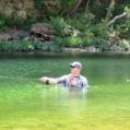
It's not far from the 45 bridge. On the walk-in site, if it's the gravel spot on the big horseshoe bend, locals drive in and there's usually some people swimming, partying and fishing there.
It's not far from the 45 bridge. On the walk-in site, if it's the gravel spot on the big horseshoe bend, locals drive in and there's usually some people swimming, partying and fishing there.
-
cpresoz
- .....
- Posts: 605
- Joined: Mon Feb 07, 2011 10:13 am
- Name: Curtis Presley
- Location: Fayetteville, Arkansas
Re: War eagle info?
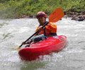
Our float Sunday was excellent. 14 of us went, with 3 canoes and 8 kayaks. Water was at 2.33 when we started. A couple of the vehicles dropped their boats off at Withrow Springs and met the rest of us coming from Springdale at the Hwy. 45 bridge. There was a no trespassing sign on the gate leading to below the bridge and as we were deciding to consolidate a couple of boats, the landowner came by to tell us he couldn't allow anybody access. So, Hwy. 45 is off as an access point. He told us about Gar Hole further downriver and Parker Ford just upriver. We headed to Parker Ford, left some vehicles and headed back to Withrow Springs. Parker Ford is a great spot. Turn east at Anderson Propane on Hwy. 45 not far from Hwy. 412. and it's the first left turn. Just avoid the private drives and though it looks like you're heading right between a couple of houses, a tight turn and a rutted road takes you to the Ford.
The float was everything we hoped it would be. The bluffs are slightly less dramatic than those on the section from Hwy. 412 to Withrow Springs. We dragged maybe once. A foot more water would have made for a faster, more exciting trip. Some of the group caught a glimpse of an eagle. We mostly saw turkey vultures, kingfishers and pileated woodpeckers. Many gravel bars with plenty of wood for camping. None of us were fishing, but I'm sure the fishing is good. I'll try to post photos soon.
The float was everything we hoped it would be. The bluffs are slightly less dramatic than those on the section from Hwy. 412 to Withrow Springs. We dragged maybe once. A foot more water would have made for a faster, more exciting trip. Some of the group caught a glimpse of an eagle. We mostly saw turkey vultures, kingfishers and pileated woodpeckers. Many gravel bars with plenty of wood for camping. None of us were fishing, but I'm sure the fishing is good. I'll try to post photos soon.
Re: War eagle info?
If anyone lives in the area and is willing to shuttle me up river on War Eagle some Saturday or Sunday, shoot me a PM. Ideally I would like to leave my truck at War Eagle Mill and have someone run me (and boat) up river to Gar Hole or Parker Ford.
Or leave my vehicle at Withrow Springs and run me (and boat) up river to HWY 412 Bridge.
I would feel comfortable leaving my vehicle at one of these two spots unattended.
I would glady pay a shuttle fee.
Or leave my vehicle at Withrow Springs and run me (and boat) up river to HWY 412 Bridge.
I would feel comfortable leaving my vehicle at one of these two spots unattended.
I would glady pay a shuttle fee.
Corey Dawe
Social Media
Who is online
Users browsing this forum: Baidu [Spider] and 0 guests